Laos
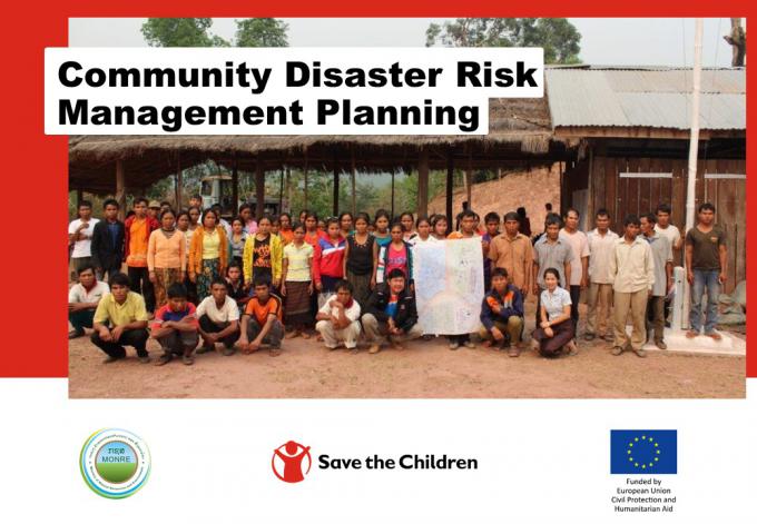
Laos Community Disaster Risk Management Planning
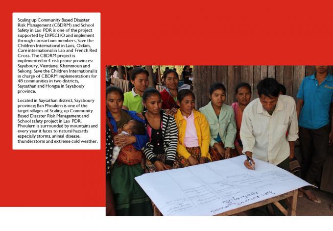
Scaling up Community Based Disaster Risk Management (CBDRM) and School Safety in Lao PDR is one of the project supported by DIPECHO and implement through consortium members, Save the Children International in Laos, Oxfam, Care international in Lao and French Red Cross. The CBDRM project is implemented in 4 risk prone provinces: Sayaboury, Vientiane, Khammoun and Sekong. Save the Children International is in charge of CBDRM implementations for 48 communities in two districts, Saysathan and Hongsa in Sayabouly province.
Located in Saysathan district, Sayaboury province; Ban Phoulern is one of the target villages of Scaling up Community Based Disaster Risk Management and School safety project in Lao PDR. Phoulern is surrounded by mountains and every year it faces to natural hazards especially storms, animal disease, thunderstorm and extreme cold weather.
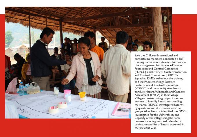
Save the Children International and consortiums members conducted a ToT training on minimum standard for disaster risk management for Province Disaster Protection and Control Committee (PDPCC) and District Disaster Protection and Control Committee (DDPCC). Saysathan DMCs rolled out the training and led Phoulern Village Disaster Protection and Control Committee (VDPCC) and community members to conduct Hazard, Vulnerable, and Capacity Assessment (HVCA) in their village. Villagers devised into groups of men and women to identify hazard surrounding their area. DDPCC investigated hazards by questions and discussions with the groups. After hazards identified, the DMCs investigated for the Vulnerability and Capacity of the village using the same process including seasonal calendar of cultivation and list of hazard occurred in the previous year.
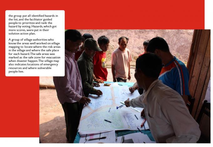
the group put all identified hazards in the list, and the facilitator guided people to prioritize and rank the hazard by voting. Hazards, which got more scores, were put in their solution action plan.
A group of village authorities who know the areas well worked on village mapping to locate where the risk areas in the village and where the safe place for each hazard. The safe areas was marked as the safe zone for evacuation when disaster happen. The village map also indicates locations of emergency resources and where vulnerable people live.
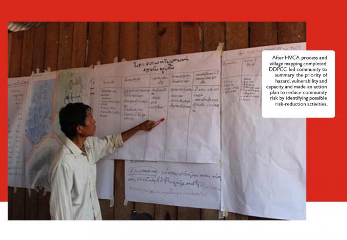
After HVCA process and village mapping completed. DDPCC led community to summary the priority of hazard, vulnerability and capacity and made an action plan to reduce community risk by identifying possible risk-reduction activities.
This project is funded by European Union Civil Protection and Humanitarian Aid
Posted by: Vilaxay Inthaxoum